GES296 - USAF Base - Mt Limbara
When you've explored as much as you can of interesting places around you, and others have moved on in their interests. It's time to find another hobby. So having reached this situation myself, after 10 years of fairly solid exploring, I looked at one of my main ways of keeping fit, cycling. Instead of doing the odd couple of laps of Richmond Park in SW London, i started to go further afield. Cycling trips became new ways to explore the countryside around London. The main thing, as with exploring metro, sewers, factories etc, was to see new things. There was a quiet hope that i'd find something that was worth exploring, but land values mean it's now getting rarer and rarer to find abandoned places in SE England. As i got better and better at cycling, and my range increased from 15miles, to 80miles and then being comfortable doing over a 100miles (a century ride in cycling parlance), I began going on overseas trips.
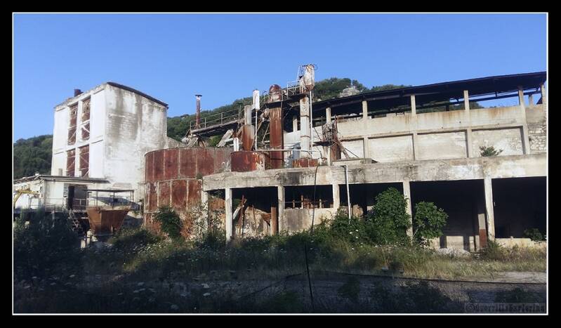
One such trip was to Sardinia. Italy, unlike the SE of England, has plenty of places where time stopped, and places were abandoned as Globalisation made them redundant and inefficient. This is some sort of factory i passed on the way to a big climb in the middle of the island. I had a feeling i'd know what i'd find inside, i kept on moving.
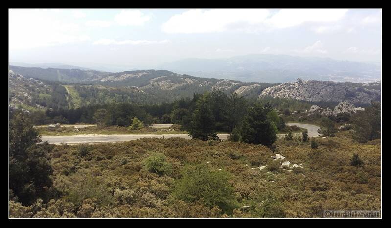
A few days later, i set off to cycle up to the island's highest point, Monte Limbara. Standing at 1362masl, it wasn't the most giant of mountains, a mere 20m higher than Ben Nevis, the highest in the UK. Cycling up would mean an 11km ride up an average gradient of 7%, maxing out at a fiendish 30% in places. Getting to the top, i would need a rest. As i managed to get to within a kilometre or so from the top, i passed a curious side road with abandoned features and huge dishes. "Hmmmm" i thought, before seeing the road continue to climb to the horizon, when i went back to thinking, "Owww." On finishing the ascent of the mountain, and cheekily cycling into the Italian military base at the summit to hit the actual summit. I pootled down to the inviting side road i'd seen before.

As one might expect with an abandoned military base, there wasn't any signage to give a clue of what the place was. My inkling was some kind of communication base. Oddly, i didn't have my dSLR and tripod with me, so all photos come from my smartphone.

I first went into the green building above. There was another building off the left of the photo above, it looked like a barracks. The interiors looked destroyed, so i didn't go there. This building had the admin and R&R facilities (Rest and Relaxation). Below is the bar area.

This corridor lead up the hill to the other buildings. This being on top of one of the highest points on the island, the Winters were likely cold and snow covered. So these walkways kept military personnel warm and toasty.

This appeared to be the main eating area, or Mess. Ironically, it was a mess of a different kind now. Metal thieves, vandals and nature had all taken their part in destroying the place.

Moving up the hill to the upper level, these would have been garages for base vehicles. Fuel would have stored in the round tanks just poking up above the wall in the centre of the photo.

The fuel would have driven these generators, stored in a building next to the garage above.

A row of cabinets facing the generators, gave a clue as to the fact that these were indeed generators.

After not seeing many words written on the base, although there was a 'US Mail' sign next to the Mess. I found this on a door to a building across the road from the generator building. Even though I knew the place was abandoned, I still felt nervous pulling the door back. 'Use of Deadly Force Authorized' wasn't something i'd seen on any explores before. The reference to an American security act confirmed this was an American base at some point. The note below showed that Italians were also working here. Just in case an Italian decided to open the door and find a convenient way to end his/her life.

As one might expect, inside there were no state secrets lying around. Just a few abandoned bits and pieces.

At the far end of this building, were a number of shutes. Shutes from above, and drop shoots that went below the building.

Looking back towards the door with the scary notice on. One might guess this was an open plan office section. People scanning communications.

Outside, the large dishes appeared to be in far better shape than the buildings. Conveniently they all had ladders up to the top.

For those non-cyclists, most of us cyclists where cleated shoes. Basically flat plastic with a plastic cleat under the ball of the foot. These shoes are designed for cycling, not for climbing metal ladders! As i slipped and slided up the ladder, i gripped the sides of the ladder ever tighter. At one point two thirds of the way up, the ladder goes from vertical-ish, to a more 45 degree angle. Again, a challenge in cycle shoes. In retrospect, a cleverer person might have gone up in socks. The red roofed building is the generator room, sitting next to the fuel tanks. Two more storage tanks sit behind it.

The red roofed building below, is where the Mess and bar can be found. The covered corridor that links the buildings. At the bottom are the barrack building, where people slept.

Looking East over more dishes. If you fly into Olbia airport, you fly past this mountain and can see the base.

The view back down, with the point where the ladder bends, not easy in cycling shoes.

The mysterious building with a lethal force policy. The large pipes bringing in all the communications.

The 6 dishes.

Feeling like i'd recovered, it was time to head back down the hairpins. When you cycle up a mountain, you lose 1c for every 100m. When you descend, it gets warmer and warmer.
I was grateful that no one had slipped off with my bike. As i rode off, two groups of dutch number plated SUVs pulled into the property. I guess this place is well known internationally.

And with that, off back to the car 40km away.
Add comment
Comments