GES166 - Counter's Creek, London
The Counters Creek, as the name suggests, used to be a small river, running into the Thames. It acquired it's name in the 18th Century, possibly from Counters Bridge which crossed it. It served to form the boundary between Kensington and Hammersmith & Fulham, which it still does today. Like most rivers in London, it was covered over and eventually sacrificed to the sewer gods. It sits in a busy area of sewers and interceptors, as this map shows. The Counters Creek sewer is the Orange one in the middle. It's side infalls weren't explored, as they're crouchers. The mouth of the creek might have once been Chelsea Creek, but it's now under a jetty around the corner. The outfall passes under Lots Road Pumping Station just prior to hitting the Thames.

Trip One
After failing at the lid i thought would get us in, helpfully it was welded shut. We went to my backup lid, and found a set of stairs leading us down. It didn't take long to realise this was indeed a poopy sewer, as Alex Residues, my companion for this drain explore, went down to check the access.. The bottom of the access stairs in this side pipe seen below.
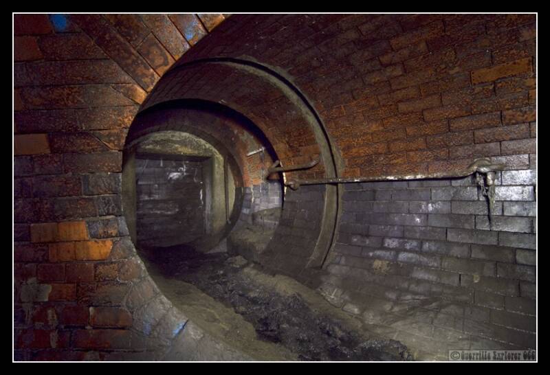
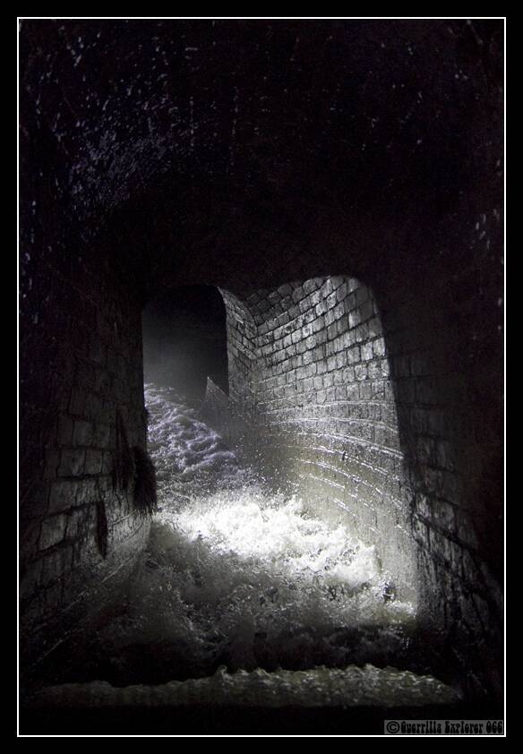
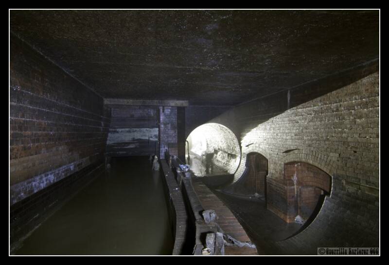
The side pipe lead into the mainline chamber, and barely a few metres ahead of us was the weir chamber for the storm relief. When the water level rises, it disappears over either side, down into the NW Storm Relief 10m below. Stairs lead down either side to a crossover tunnel below the main sewer. The main flow into the Storm Relief is on the left. (Point 1 on the Map)
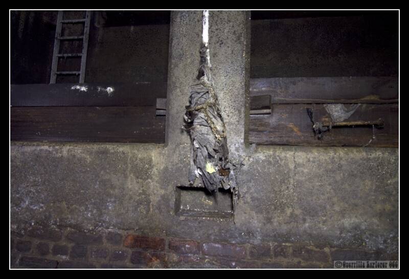
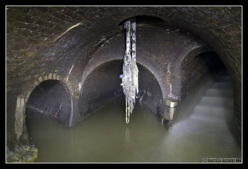
Close up of the flotsam that collects on anything that sticks out in the main chamber. Most of this is moist tissues, that don't break down easily. This also sticks above the main flow, so one can see how often it floods.
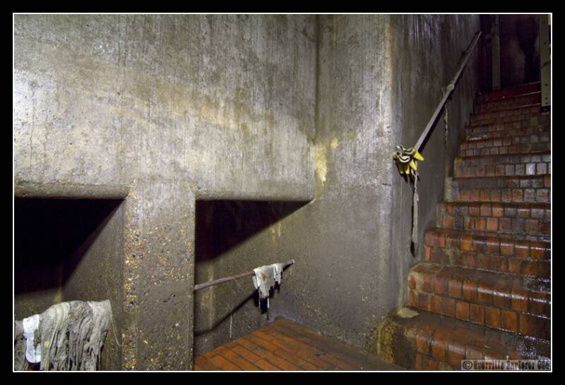
The stairs down on the left of the main picture of the weir chamber above. The two holes lead to a drop shaft into the North West Storm relief. To the right of the shot is a low passage under the main counters creek tunnel.
We walked further upstream, and reached a junction a few minutes after the weir chamber. It had three pipes meeting here. One came from above and bubbled down over steps into the main Counters creek tunnel. Seen here from the top of the stairs. The passage at the top went under the pavement of Holland Park Avenue.
A three shot, showing the bottom of the stairs in the above shot. The ladder goes up to a manhole, the main chamber is on the other side of the ladder. Another local sewer enters the main tunnel on the left.
We passed back through the main weir chamber with the NWSR, and were ready to plough south. The tunnel on the left, is the one we entered the main chamber originally. We progressed on for about half an hour before finding an exit lid. There wasn't much to see. Apart from two main areas, the Counters Creek is pretty featureless. A long straight tunnel full of crud, built up over time.
We exited near the Olympia exhibition halls, and called it a night. We weren't far from the interceptor, so something to look forward to for a return trip.
TRIP 2
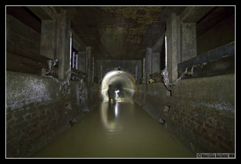
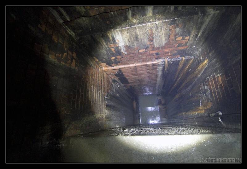
Returning to the lid we exited from last time, we slipped out of the darkened weekday evening, and descended once more into the mire. The air had a mild air of putridness to it, and the dark, deep, slow moving stream filled around us, as we climbed in. I listened carefully, and couldn't hear the sound of an interceptor, even though we were very close according to the map. Eventually we reached the interceptor, and found out why we hadn't heard anything. This shot is looking out of the interceptor chamber back up the mainline tunnel to our access point.

Residues sits in the mainline tunnel continuation. On the right is the interceptor from the West crossing the Counters creek, on the left is the channel for the interceptor to continue east..The metal grill above Residues is an access point for workers from the surface. (This is point 2 on the Map)
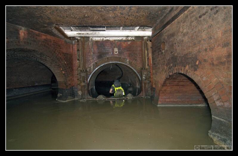
Looking North upstream from the mainline continuation, where Residues was sat in the image above.

A few metres around the corner from the above shot, we see the interceptor, a weir chamber, and the continuation of the mainline branch.
On the left is the interceptor. I stood in this to light a shot for Residues and found myself being sucked off down the interceptor, it has a strong current pulling downstream. I was happy to have got out of it. In the middle of the shot is the weir, where the interceptor would overflow in heavy periods. The two openings in the wall lead down into the storm relief, 8m or so lower down.
A reverse shot of the weir chamber
A shot from inside the openings into the overflow into the storm relief (front left of photo below).

8m drop shaft into the Storm Relief. Not somewhere I'd want to fall down.
The mainline tunnel of the Sewer carried on, around the corner and was a long straight featureless nightmare.
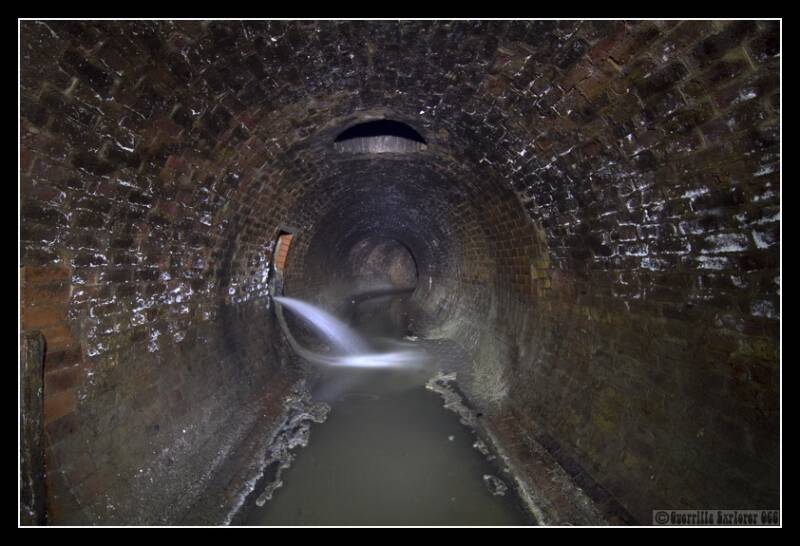
What followed was half an hour of one of the downsides of draining. Walking through tough sticky crud. It was difficult to put our feet down flat, and we ended up walking along the sides, our feet constantly angled. It was a joy to reach a fast flowing tributary which kept the crud at bay. However it was only a few metres until our exit point. I think this will be one of the few drains I walk the entire length of.
TRIP 3
After a long break, it was finally all things go and I could finish off this drain down to the outfall. Residues joined me to finish off his first full drain. Counters is mostly a long straight drain with a fairly permanent line of crud on the bottom, making it tricky to walk down at times. So we opted to skip a kilometre, and enter at one of the last lids we could get open before the outfall, this was about 1km away. We got wadered up, and I noticed that my rubber waders had a hole just below the knee, balls! I would see how far I could get.
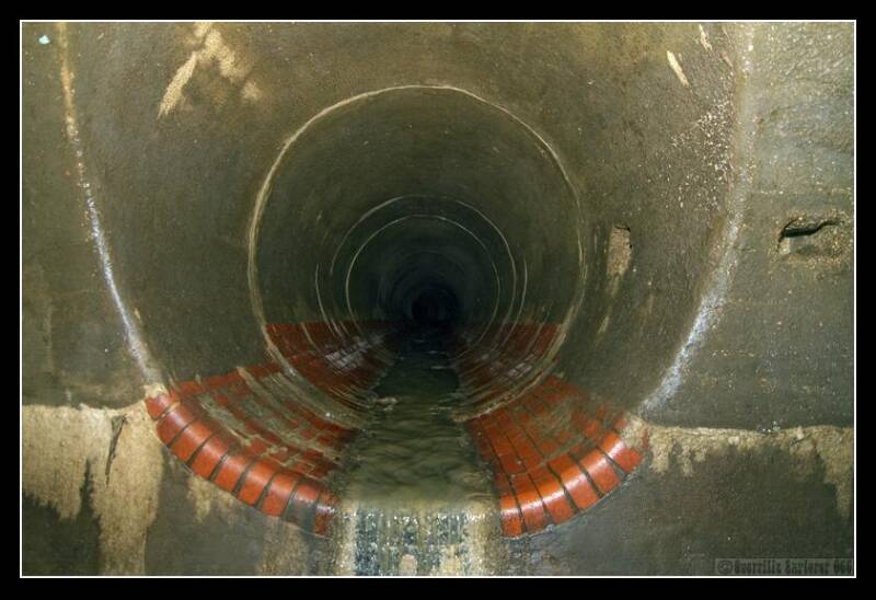
I got the lid open, and was confronted by quite the drop down to the bottom of the ladder shaft, about 8-10m. Residues descended while I tried to look official on the surface. The road the lid sits on is usually insanely busy as a main thoroughfare in Earls Court, but today eerily quiet. He shouted up that all was good, and I came down after him. The tunnel barrel was fairly brown and concretey, as seen below. This is where elements of the Church St sewer feed into Counters Creek. The tunnel on the left leads up Fulham Rd under Chelsea. The tunnel higher up on the right of the main tunnel, leads to outside Chelsea Football ground. (This is Point 3 on the Map)
The Church St sewer that continues down Fulham Rd, not really a goer for exploring unless you're the size of an action man.
This is the Church St sewer that comes from Fulham Broadway, passing south of Chelsea FC's ground. It appeared to be concreted over bricks, a tragedy. I walked up it for a 100m or so, but it only had a manhole exit. I went a bit further but it was RCP and the air didn't smell too good.
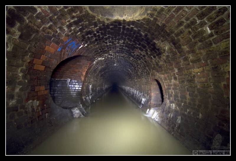
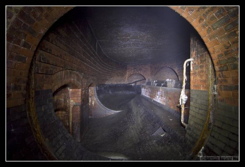
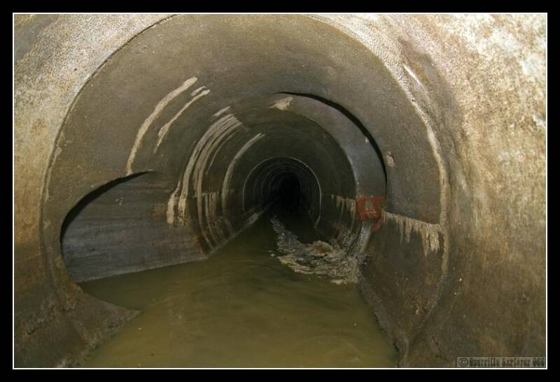
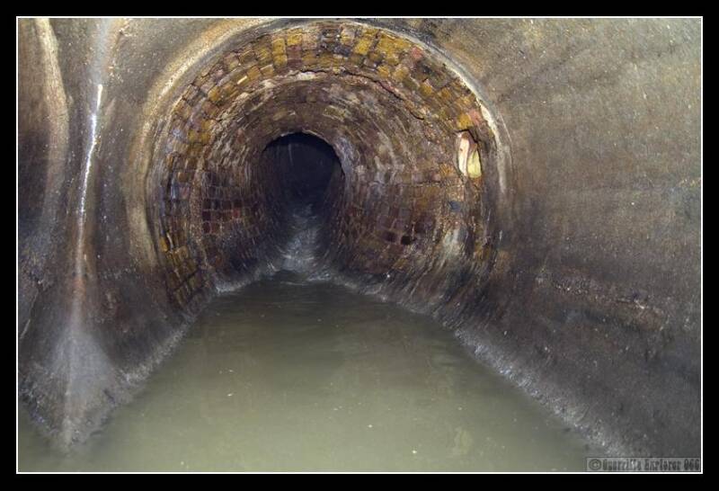
The tunnel continued as before, with little of interest. Then, about 200m from the outfall, it widened and increased in height. 20m down the now brick pipe, there was a side exit to a manhole, and at the base of the ladder was a side pipe about 1m high, I believe this was another branch of the Church St sewer. The shot below shows the tunnel, this is about 25m from the diversion into the Outfall. I managed to get up to the two side pipes, but the water started getting deeper and I had to turn back to the ladder I took this shot below from. The dark area at the back of the shot is the interceptor diversion. This wider orangey red brick section is likely to be where the Kensington canal used to run, assisting the Sands End gas works and Lots Rd Power Station, just to the West of this part of the drain.

Luckily Residues's waders were good, and he set off with my camera and flashgun, these shots were taken by him. Slurry piles up near the diversion, the other side of the safety rail. (This is point 4 on the Map)

Unfortunately Residues must have knocked the focus ring, but I've included it as it's just about visible what's going on. The other side of the safety rail is a weir into the interceptor exchange in the pit ahead of it. Beyond in the gloom is the overflow down to the Thames. On the right wall are hold rails and foot places, for crossing the interceptor diversion.

With no way out down here, it was then the hike back to where we entered. I'm tempted to come back and visit the outfall properly, but that will have to wait for another day.
Big thanks to Residues for outfall snaps and company all the way down.
Add comment
Comments